Does anyone know if I can plot devices on a custom graphic, such as a floorplan? (understandably, long / lat is not the same, if at all)
Something where I can put down where a printer is located for example via X / Y coords?
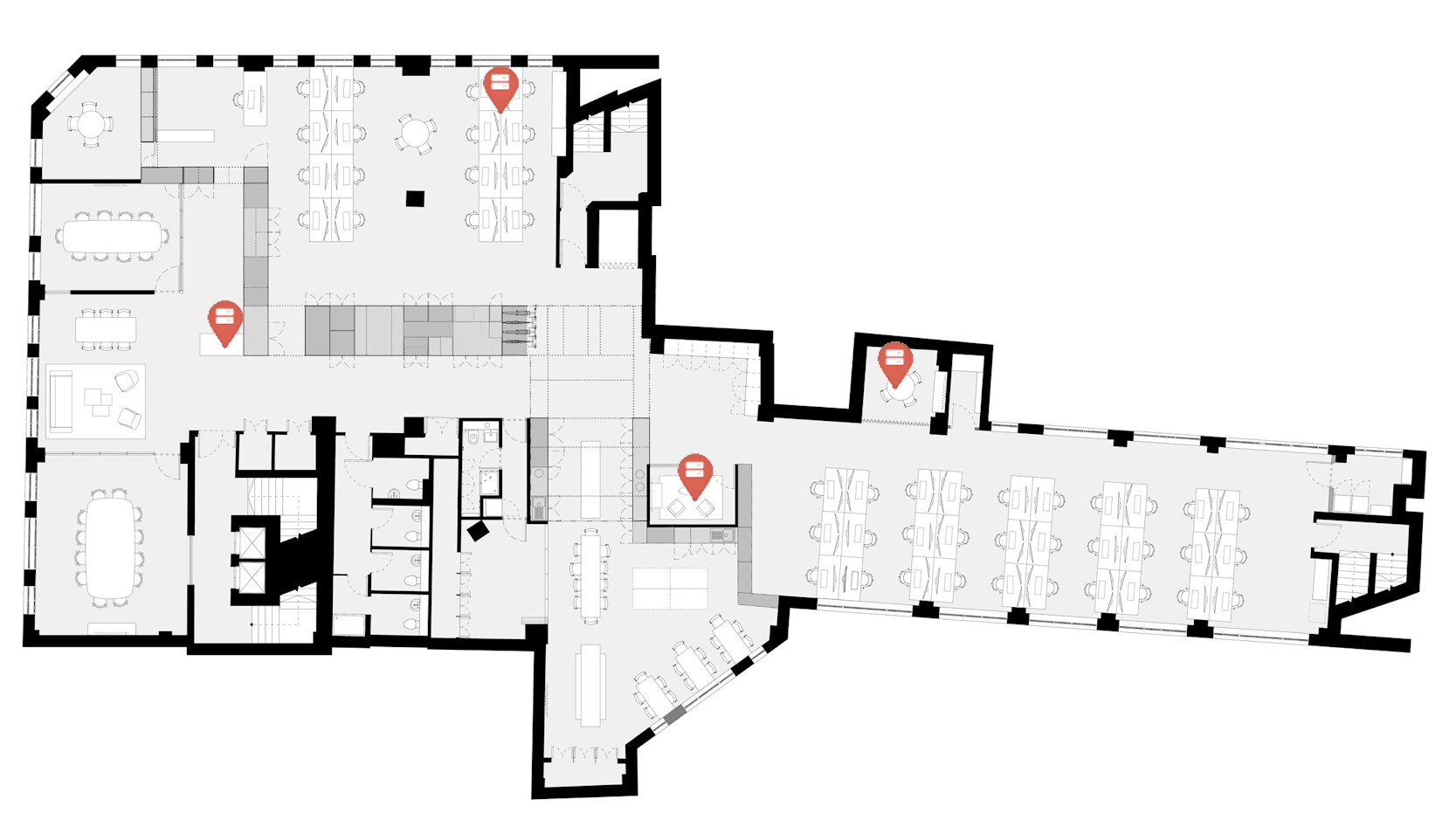
Something similar to this mock up shot I’ve made. oV1tPUN.png (1667×931) (imgur.com)
(I hear I can’t change the icon, depicting the device, that’s fine)
Thanks all for the hard work, it’s super appreciated.
I’ve seen people suggest something along those lines, I was hoping someone had whipped something up. I can see people looking eagerly for this many years ago.
I’d gladly just drop in a very high res bitmap into a folder say 2560x1440 or so and then plot printer at X / Y whatever, if that makes sense.
Really could be useful for how we’re using librenms.
Any updates on the progress of this one? It’s a very cool idea.
Obviously, we’d need to impliment some kind of custom long / lat in order to plot the dots on the bitmap / jpg in the correct locations.
sorry, I forgot that I had responded to this post. I was originally thinking about using long / lat to place devices from the locations, but we don’t keep accurate enough data for every device for this to be useful. The new custom map functionality does allow for a background image to be uploaded, and then for devices to be added and dragged to the correct spot on the map.
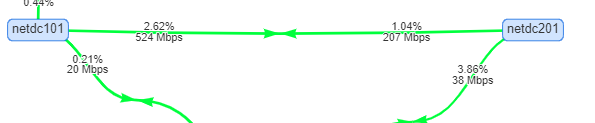
You can add any device you have into it as nodes, and then add ‘Edge’ known as the lines between two devices by selecting an interface on one of the nodes.
In terms of the mapping, the background is no difference to your desktop wallpaper so it has nothing to do with lats/long
The weathermap wont tell you if the node is up or down like the other map does, it’ll only show you from a view on the bandwidth of an Edge line based on the set bandwidth you add against it. I don’t think Weathermap does what you’re wanting it to do.
Ok so I am specifically after a custom, floormap, allowing me to show deices on that floormap and identify if they’re in a good or bad stae.
Identical to the existing world map, but using a large bitmap of my choices as a base model image for the ‘world’
I would suspect long / lag on the chart would need to be either custom special figures like pixel coords (2510 x 1405for example would be an item in the very bottom right corner)
Honestly, I don’t know, it’s not up to me to design it, just to come up with ideas that I hope, someone else can do in time
I def want to show as per my image above tho, devices on the map and the state. As per existing world map
Hi,
I’m also trying to position the AP wifi on a floor plan, like you.
I’ve decided to use the “Custom maps” function, but I’m getting an error : “Flasher is not loaded”.
I opened a post with screenshot for that : Custom maps : empty loading background
And you also have this problem ? can you test for me ?
Thanks
I actually have no idea, how I can place an item on multiple maps?
Obviously there’s the primary global map which is useful. Then I want a map per building, so for example a printer which is in new York should be on the global map at the NYC office coordinates, however I also want the printer on the level 1 NYC office floor map.
Hello community,
I would be interested in developing/improving a version/plugin of the MAPS → GEOGRAPHICAL tool.
Instead of using the Leaflet engine, it could use OpenLevelUp OpenLevelUp!.
This would make it possible to geolocate indoor equipment or by level.
Do not hesitate to contact me or to give me some hints to get started? Thanks
A+
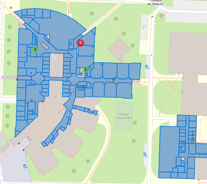
I’ve developed a piece of code to display the Librenms map with a floor selector like https://indoorequal.org.
We’re lucky to have GeoJSON data for our buildings / floors / Ref / name / imported into Leaflet.
Here’s the result if you’re interested. This add-on is not in the form of a plugin, so you’ll have to modify the files manually each time you update (./daily.sh).
The steps :
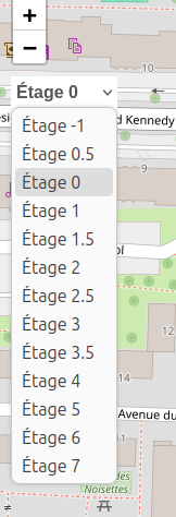
1 - Check that your buildings have a floor view on: https://indoorequal.org
2 - Export your building geojson files to https://overpass-turbo.eu/
3 - Copy your geojson files to /librenms/html/tiles
4 - Modify the code /librenms/html/js/librenms.js
5 - Modify the code /librenms/html/css/styles.css
